Trail Walking Shimogyo Ward - visite avec la guide. kyoto temples - Photo

visite avec la guide. kyoto temples

© OpenStreetMap contributors
Length
Length
18.7 km
Max alt
Max alt
126 m
Uphill gradient
Uphill gradient
233 m
Km-Effort
Km-Effort  
22 km
Min alt
Min alt
30 m
Downhill gradient
Downhill gradient
234 m
Boucle
Boucle
Yes
Creation date :
2024-07-18 00:08:08.522
Updated on :
2024-07-18 12:12:24.041

(0 Reviews)

Walking
Walking
5h27
Difficulty : Medium

Scan this QR Code to open this trail in the SityTrail application

FREE GPS app for hiking

Logo SityTrail SityTrail

IGN / Geographical institutes

Download SityTrail from the App Store Download SityTrail from Google Play

Logo SityTrail SityTrail World

The world is yours!

Download SityTrail from the App Store Download SityTrail from Google Play Download SityTrail on Huawei AppGallery

About

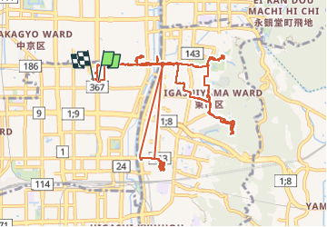
Trail Walking of 18.7 km to be discovered at Kyoto Prefecture, Unknown, Shimogyo Ward. This trail is proposed by patrice_baras@yahoo.fr.

Description

geishas.  temples

Elevation profile

Positioning

Country:
Japan
Region :
Kyoto Prefecture
Department/Province :
Unknown
Municipality :
Shimogyo Ward
Location:
Unknown
Start:(UTM)
569335 ; 3873461 (53S) N.

Trails nearby

Trail Car Minami Ward - 20240603 Kyoto Tottori  - Photo
Car
Childebert

Car

Very easy
Minami Ward, Kyoto Prefecture, Unknown, Japan
233 km | 344 km-effort
14h 0min
No
Trail Car Minami Ward - 20240602 Kyoto  - Photo
Car
Childebert

Car

Easy
Minami Ward, Kyoto Prefecture, Unknown, Japan
32 km | 36 km-effort
9h 46min
Yes
Trail Trail Sakyo Ward - Kyoto otsu - Photo
Trail
Heudor

Trail

Difficult
Sakyo Ward, Kyoto Prefecture, Unknown, Japan
7.6 km | 14.8 km-effort
4h 30min
No
Trail Walking Shimogyo Ward - 20240601 gare restaurant  - Photo
Walking
Childebert

Walking

Easy
Shimogyo Ward, Kyoto Prefecture, Unknown, Japan
2.1 km | 2.6 km-effort
3h 13min
Yes


Close
My subscriptions